Posts

Showing posts from June, 2020

The parkrun 20202020 challenge - Number 9

Image
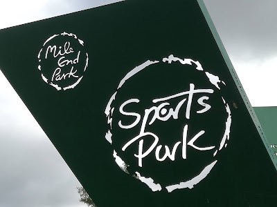
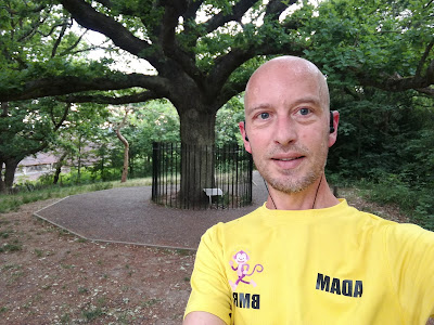
I ran to the East End for my next parkrun. Mile End to be precise. To get there I used the Greenwich tunnel under the Thames for the first time. It was empty and an eerie but unpleasant jog beneath the river. I emerged on the Isle of Dogs and headed towards the skyscrapers of Canary Wharf via Mudchute Park and Farm. This was a pleasant green space beneath the shadows of concrete and glass. On reaching Regent’s Canal I followed it north until arriving at Mile End Park. There is an athletics stadium at the base of the long, narrow stretch of parkland. This was the start and finish point of the run. After 5 minutes to catch my breath after the first 7 miles warm up I started out. There is a double path winding north. The left side in for pedestrians and the right for cyclists. I hadn’t scoped out the route, but it seemed quite straight forward. The path wound its way for about a quarter of a mile before reaching the Green Bridge over Mile End Road. It was a steep climb and I

London A-Z Part 4 (S-W)

Image
This is the penultimate part of my A-Z run through London. Each run must begin and finish at my home in Lewisham. S - Sydenham Sydenham is a district of south-east London, England, which is shared between the London boroughs of Lewisham, Bromley and Southwark. I ran through Sydenham on my way to Dulwich for my 8th parkrun 20202020 Challenge . I didn't realise just how steep Sydenham Hill is! Famous residents: Antarctic Explorer Ernest Shackleton and Cricketer WG Grace lived in Sydenham. Writer and Literature Nobel Prize winner Kazuo Ishiguro wrote his novel Remain of the Day here. T - Tulse Hill Tulse Hill lies to the south of Brixton, east of Brixton Hill, north of West Norwood and west of West Dulwich. Famous residents: Singer Julian Cope and The Clash guitarist Mick Jones lived here. U - Upper Norwood Upper Norwood is situated along the London clay ridge known as Beulah Hill. It is at the top of a long steep road called Anerley Hill. Crystal Palace

The parkrun 20202020 challenge - Number 8

Image
Dulwich parkrun was up next, a nice flat triple loop of the park. I ran there via Sydenham for the S of my London A-Z. Unfortunately the map didn't reveal the elevation and I arrived having climbed the steep Sydenham Hill. I did a reccy lap to cool down and ensure I had the course right. It was a good job I did as I would have started at the wrong entrance. Once at the right start point I set off quick. At Southwark I did a slower first mile before speeding up towards the end. This time I thought I would try a strong first mile and try to sustain it. If I was tired on the third mile I could afford to ease off and still manage a sub 20. The park was relatively full for an evening. I had to cancel my usual morning run and had arrived at 7pm. It was overcast but humid and the sweat was soon dripping down my bald head. Fortunately the path is very wide and so social distancing was not a problem at all. The course is basically a squashed circle around the lake with a few small

The parkrun 20202020 challenge - Number 7

Image
Not a happy bunny thanks to my Garmin This time I was aiming to run Southwark parkrun in under 20 minutes. It is a flat course so I hoped I would be able to achieve my goal despite having run 30 miles the weekend before. I ran there from Lewisham, a distance of four miles and then ran one lap to reccy the course. It was quite straight forward. Three anti-clockwise laps of the southern end of the park. It starts by the China Gate and heads north before doing turning left and left again to pass around the children's playground. The path emerges between the Gallery and the Café and turns to the right. Once past the Boat House it is another sharp right which then leads along a track beneath trees towards the Ada Salter Rose Garden and turns 180 degrees to head back parallel to the path and on past the Boat House again and the cricket pitch on the left hand side. The path curves gently to the left, skirts the athletic track and then reaches a fork. On the first lap you take

London A-Z Part 3 (M-R)

Image
M - Mottingham Mottingham is an area south-east of Lewisham between Lee and Eltham. There isn't much to say about it other than it involved a long, slow climb to get there on a very hot Tuesday evening. Famous residents: For such a small place it certainly has some notable people associated with it including Cricketer WG Grace, athlete, missionary and inspiration for the film of Chariots of Fire Eric Liddell, Comedian Rob Beckett (with the teeth), and Politician Denis Healy. N - Nunhead Nunhead is a place in Peckham in the London Borough of Southwark in London, England. It was first named in 1680 after the local inn called The Nun’s Head. Rumour has it that this referred to the beheading of a nun during the dissolution of the monasteries. I managed to get completely lost despite the short distance and ended up in Higher Oak. I managed to curl my way back to Brockley and was glad I did as it gave me the opportunity to see The Oak of Honour on top of One Tree Hill

The parkrun 20202020 challenge - Number 6

Image
My sixth challenge of the year was Peckham Rye parkrun. This is a flat course about 3 miles from where I live. I had hoped to do Hilly Fields before  but the elevation on that one has been putting me off... I arranged to do this as part of my London A-Z run for the letter P. It was a muggy overcast morning as I jogged over to the park via One Tree Hill, ironically a thickly forested hill but with a notable oak tree from which it now takes its name. The park was quite busy with dog walkers and joggers even though it was only 7am. I did a quick reccy of the course which involved a few corners and turns. After a lap it was quite easy to navigate. I would need to run three laps anti-clockwise. The run began on a wide path and headed north towards the pond before curving to the right beside the Arboretum. I felt strong and found myself bouncing along on my toes but this soon began to hurt my calves so I settled into my usual mid foot strike as I turned left and then right again a

Running the Ravensbourne River

Image
On Saturday 30th May at 7am I set off to run the length of the River Ravensbourne from it's source in Keston to the River Thames in Deptford. My guide for the journey was a guy called Mike GTN. I've no idea who he is but stumbled on his blog in which he recounted his walk along the same route. I was in two minds until the morning of my run whether to begin at the Thames and seek out the source of the river or follow the water from it's origin to the outflow. In the end I decided on the latter as I knew the section from Catford to Deptford well and wanted to be at my sharpest for the unknown stretch. Mainly due to my history of poor navigation. The length of the river is 11 miles, however I needed to run to the source from Lewisham which is roughly 7 miles. I also added another few miles due to my A-Z Challenge. Keston is not far from Orpington and I needed an O. So the route was as follows: Lewisham to Orpington, Orpington to Keston, Keston to Deptford and Deptfo